The Kansas Ag-Climate Update is a joint effort between our climate and extension specialists. Every month the update includes a brief summary of that month, agronomic impacts, relevant maps and graphs, 1-month temperature and precipitation outlooks, monthly extremes, and notable highlights.
February 2021: 5th Coldest in our Instrumental Climate Records
Statewide average temperature for February was 22.9oF, which is 11.0 degrees colder than normal. This ranks as the 5th coldest February on available records. The West Central Division was the closest to the normal with an average of 23.0oF, 10.0 degrees cooler than normal. The Northeast Division was the coldest, with an average of 20.1oF, 12.1 degrees colder than normal. The extreme cold temperatures bring concern of cold damage to the wheat crop (Figure 1).
February was much drier than normal at all divisions, ranking as the 18th driest February since 1895. The Southwest Division was the driest with 13 percent of normal, resulting in continuing drought in the west. The dryness in north-central and western Kansas increased the chance of cold damage to the wheat.
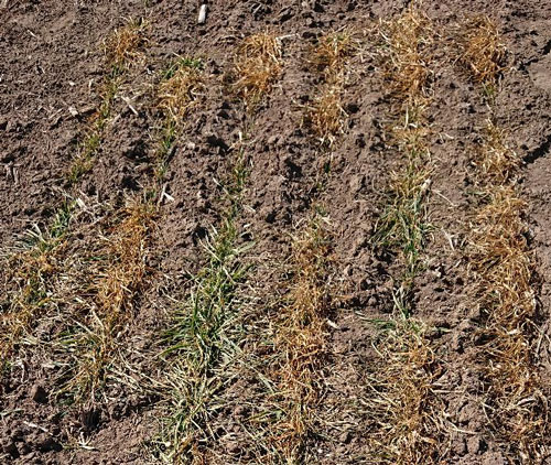
Figure 1. Leaf burn observed on winter wheat plots. Photo by G. Zhang, K-State Research and Extension.
View the entire February Ag-Climate Update, including the accompanying maps and graphics (not shown in this short article), at http://climate.k-state.edu/ag/updates/.