The Kansas Ag-Climate Update is a joint effort between our climate and extension specialists. Every month the update includes a brief summary of that month, agronomic impacts, relevant maps and graphs, 1-month temperature and precipitation outlooks, monthly extremes, and notable highlights.
May 2021: Typical Atmospheric Cooling Pattern in Kansas
Due to precipitation abundance, drought was essentially eliminated in May. At the end of the month, 97 percent of the state was drought-free and only 3 percent was abnormally dry. The June precipitation outlook favors neutral conditions across the state. The temperature outlook calls for cooler-than-normal conditions across much of the state. If a warm, dry pattern develops instead, it could result in a rapid return of drought conditions.
Severe weather season exploded in May with the report of 34 tornadoes, 159 hail events (Figure 1), and 116 damaging wind events due to unstable atmospheric conditions. In addition, there were numerous flash flood events across the state. The excess moisture, in addition to creating flood issues, also caused damage to wheat. Additional agricultural issues came in the form of delayed planting and emergence of corn and soybeans, problems with weed, fungicide, and pesticide applications, and delays in cutting hay.
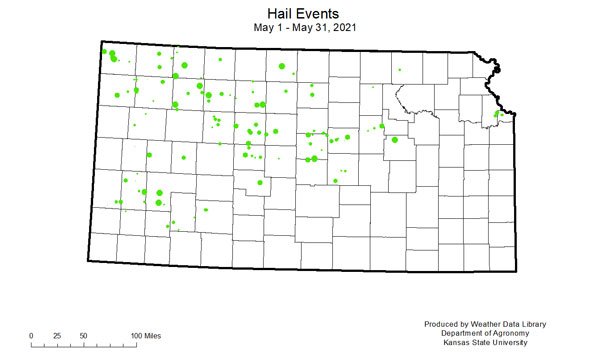
Figure 1. Hail events in Kansas for May 2021. Source: Kansas Weather Data Library.
View the entire May Ag-Climate Update, including the accompanying maps and graphics (not shown in this short article), at http://climate.k-state.edu/ag/updates/.