The Ag-Climate Update is a joint effort between our climate and extension specialists. Every month the update includes a brief summary of that month, agronomic impacts, relevant maps and graphs, 1-month temperature and precipitation outlooks, monthly extremes, and notable highlights.
August 2020: Mostly cool and dry across the state
August was much drier than normal. It ranked as the 12th driest August since 1895. All divisions averaged below normal for the month, intensifying drought in the west and with slow drought expansion in the east. Lack of moisture had negative impacts on dryland corn (Figure 1). Statewide average precipitation was 1.62 inches, 49% of normal. The West Central Division was the wettest with an average of 2.27 inches, 89% of normal. Overall, there were 12 new daily precipitation records in the state. Leoti in Wichita County had the highest total at 4.56 inches.
Temperatures were close to normal. The statewide average for August was just 0.5 degrees cooler than normal. The thermal heat unit accumulation was driven by warm minimum temperatures. Statewide there was one new daily record highs and six new record warm lows.
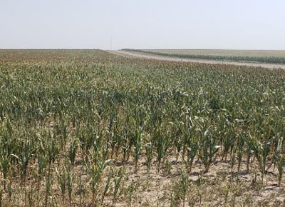
Figure 1. Drought-stressed corn in Wallace County. Photo by L. Schemm
View the entire August Ag-Climate Summary, including the accompanying maps and graphics (not shown in this summary), at http://climate.k-state.edu/ag/updates/.