The Kansas Ag-Climate Update is a joint effort between our climate and extension specialists. Every month the update includes a brief summary of that month, agronomic impacts, relevant maps and graphs, 1-month temperature and precipitation outlooks, monthly extremes, and notable highlights.
August 2021: Warm and dry, with isolated heavy rain
August was drier than normal; it ranked as the 42nd driest August since 1895. Only the Northeast Division was above normal. As a percent of normal, the Northwest Division was the driest with 0.95 inches, 34 percent of normal. The Northeast was the wettest at 4.22 inches, 107 percent of normal. Dry weather stressed corn, sorghum, and soybeans, particularly the late-planted fields. Dry soil conditions, particularly in the west, are a concern as producers anticipate planting fall crops.
Warmer than average temperatures accelerated changes to the US Drought monitor (Figure 1). The statewide average for August was 1.7 degrees warmer than normal, ranking it as the 36th warmest August of record. There were 12 new daily record high maximum temperatures and 60 record warm minimum temperatures. There were no new record low maximums, but 17 record low minimums. Severe weather was more prevalent in August with the report of 1 tornado, 69 hail events, and 111 damaging wind events.
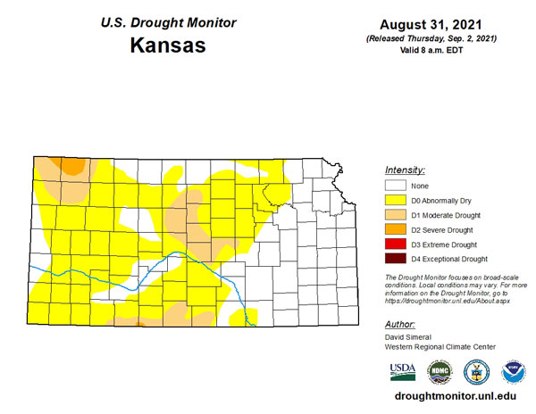
Figure 1. Drought monitor for Kansas as of August 31, 2021. Source: droughtmonitor.unl.edu
View the entire August Ag-Climate Update, including the accompanying maps and graphics (not shown in this short article), at http://climate.k-state.edu/ag/updates/