The Ag-Climate Update is a joint effort between our climate and extension specialists. Every month the update includes a brief summary of that month, agronomic impacts, relevant maps and graphs, 1-month temperature and precipitation outlooks, monthly extremes, and notable highlights.
September 2020: Temperatures oscillated along with little precipitation
September was much drier than normal. It ranked as the 22nd driest September since 1895. All divisions averaged below normal for the month, resulting in expansion of drought across the state (Figure 1). At the end of September, only 23% of the state had no drought or abnormally dry conditions in place.
Temperatures were cooler than normal. The statewide average for September was 1.6 degrees cooler than normal. The thermal heat unit was largely driven by warm maximum temperatures. Statewide there were 29 new daily record highs and 1 new record warm low.
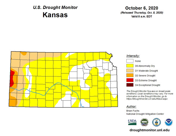
Figure 1. Drought monitor for Kansas as of October 6, 2020.
View the entire September Ag-Climate Summary, including the accompanying maps and graphics (not shown in this summary), at http://climate.k-state.edu/ag/updates/.